- The meeting will be held for three days from February 14-16, 2023.
- Participation of 45 delegates from 14 Arab countries and some of the most prominent international experts in the sector
- Preceded by a workshop titled “integrated geospatial information framework” on February 12-13, 2023
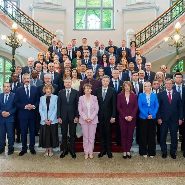
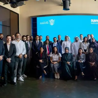
Abu Dhabi, UAE: The UAE, represented by Federal Geographic information Center (FGIC), will host the 10th meeting of the Arab Committee of the United Nations Experts on Geospatial Information Management (UN-GGIM), which will be held in Abu Dhabi on February 14-16.
The meeting is joined by 45 geospatial delegates from 14 Arab countries, in addition to the experts from UN-GGIM, and representatives of the Secretariat of the United Nations Committee of Experts on Global Geospatial Information Management. Furthermore, the event will host some of the most prominent international experts working in the field of geospatial data to highlight the contributions of the United Nations, international institutions, and the best local and global expertise in the geospatial field.
This event, which is being held for the second time in the UAE, is an affirmation of its leading position and continuous efforts to develop the geospatial data sector in the region, which is considered a strategic direction that contributes to the comprehensive progress of various countries. In addition to the UAE's active role in enhancing cooperation between various Arab countries to develop innovative solutions that advance the geospatial data sector locally and globally.
The meeting will also be preceded by a workshop presented by experts in the field of geospatial sector, held on February 12-13, under the title “Integrated Geospatial Information Framework,” which will highlight possible studies for enhancing the management of national geospatial sector to promote cooperation between countries and find radical solutions to support the sector.
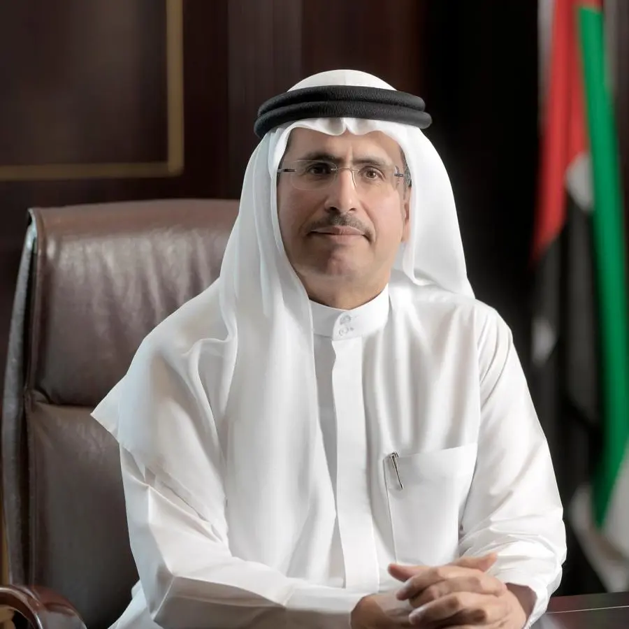
Hamed Khamis Al Kaabi, Director-General of Federal Geographic Information Center (FGIC), said: “We are proud to host the 10th meeting of the Arab Committee of UN Experts on Geospatial Information Management and the regional workshop in the UAE, which confirms the country’s leading position in the development of a sustainable environment and an integrated infrastructure for geospatial data. This event will allow us to highlight the leading role of Arab countries in the use and development of geospatial data, in addition to discussing various topics of significant importance in the sector and exchanging knowledge and expertise to find innovative solutions to develop the geospatial sector. This will contribute to the support of various sectors and will promote the economic growth in the UAE and the region.”
“The UAE has a distinct infrastructure with integrated elements, supported by geospatial data whose sources vary from the surrounding environment to space, and this comes as a result of the country's active investment in this field over the past two decades. It also boasts pioneering experience in empowering women in the geospatial information sector, as well as managing and developing geodetic information and geodetic networks, which we look forward to highlighting during the tenth meeting of the Committee.” He added.
The Arab Committee was established in accordance with the resolution issued by the 4th session of the UN-GGIM held in New York in 2014, and the Committee is responsible for identifying regional topics related to geospatial information management, in order to reach optimum solutions and achieve economic, social, and environmental goals.
-Ends-