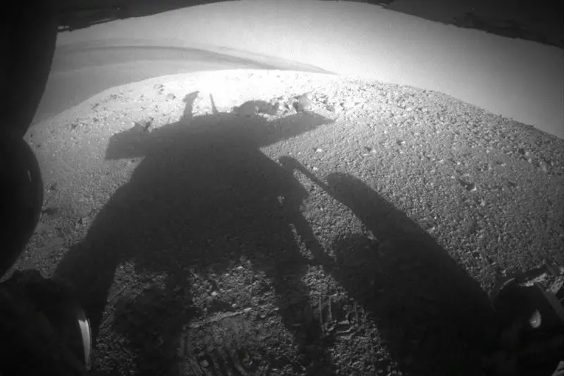
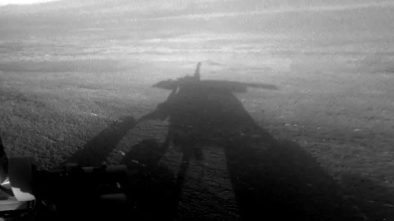
The shadow of NASA's Mars Exploration Rover Opportunity is pictured in this late-afternoon NASA handout image taken by the rover's rear hazard avoidance camera March 20, 2014. The rover's shadow falls across a slope called the McClure-Beverlin Escarpment on the western rim of Endeavour Crater, where Opportunity is investigating rock layers for evidence about ancient environments. REUTERS/NASA/JPL-Caltech/Handout via Reuters
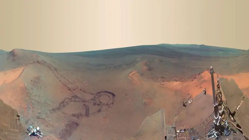
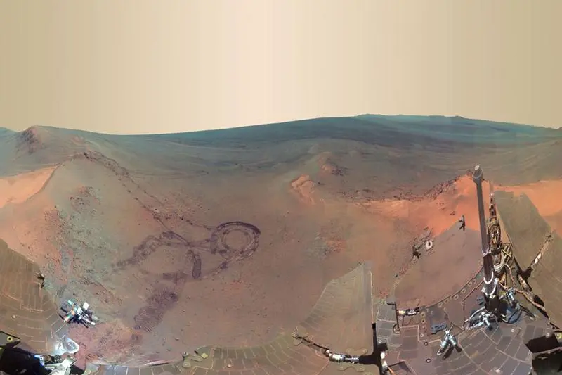
This NASA 360-degree digitally-compressed panorama image of Mars made from some of 800 images sent from the Opportunity rover on Mars shown in exaggerated colors to highlight different surface features released on July 9, 2012, shows past tracks of Opportunity (L) as well as Opportunity's dust covered solar panels cross the image bottom and an interior wall of 20-kilometer Endeavour Crater just below the horizon and right of center. Now that the northern Martian winter is over, Opportunity is rolling again, this time straight ahead (north). The rover is set to investigate unusual light-colored soil patches as it begins again to further explore the inside of Endeavour, a crater that may hold some of the oldest features yet visited.
REUTERS/NASA/JPL-Caltech/Cornell/Arizona State University/Handout
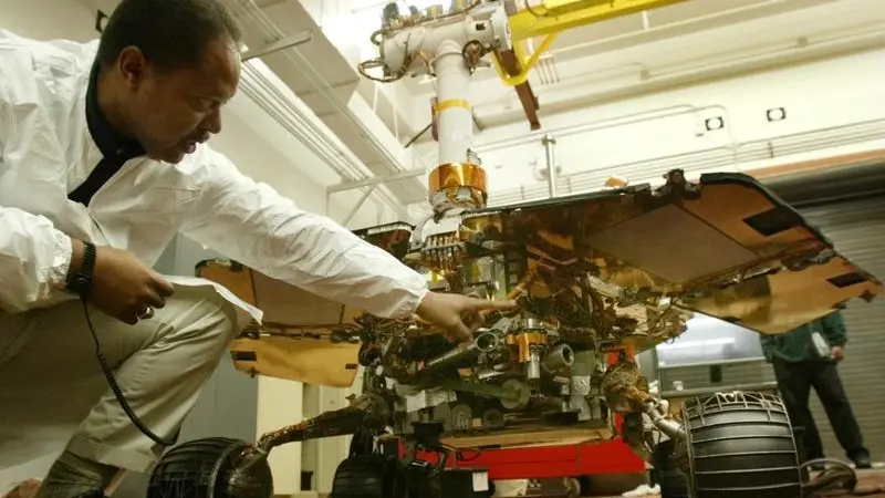
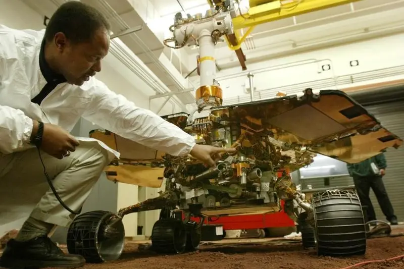
NASA JPL Senior Engineer Dr. Edward W. Tunstel Jr. points out features on a life-size replica of NASA's Mars 'Opportunity' rover at the In-Situ Instrument Laboratory at Jet Propulsion Laboratory in Pasadena, California, February 4, 2004. Opportunity, NASA's second of two roving Mars probes, rolled 10 feet off its lander onto Mars January 31 after having landed in a shallow impact crater at Meridiani Planum late January 24. REUTERS/Lucy Nicholson LN/HB
An image from the navigation camera on the Mars Exploration Rover Opportunity is shown projected to give an overhead perspective of the rover after it touched down at Meridiani Planum, Mars, at approximately 9.05pm PST on January 24, 2004. Image was released at the Jet Propulsion Laboratory, Pasadena, California, January 26, 2004.
(CREDIT : REUTERS/NASA/JPL)
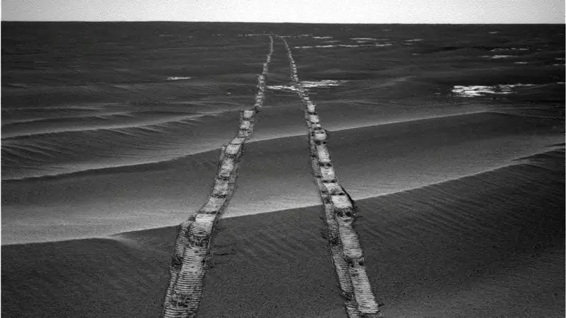
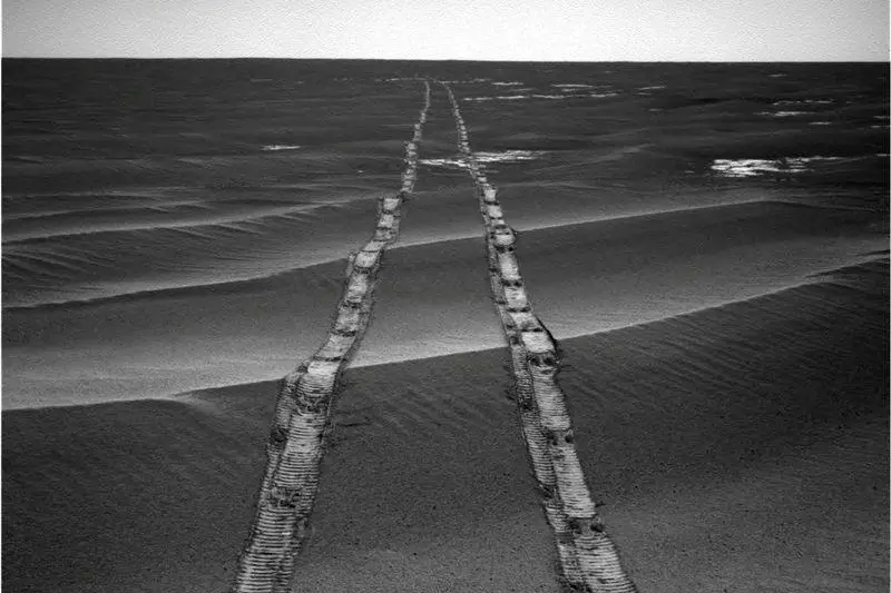
NASA's Mars Exploration Rover Opportunity tracks on planet Mars are visible in this August 4, 2010.
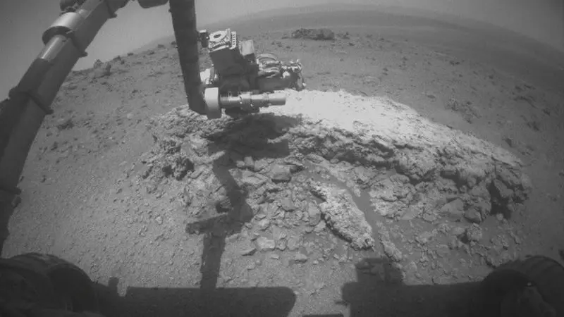
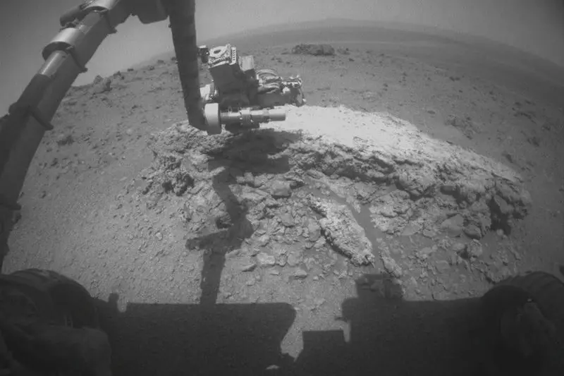
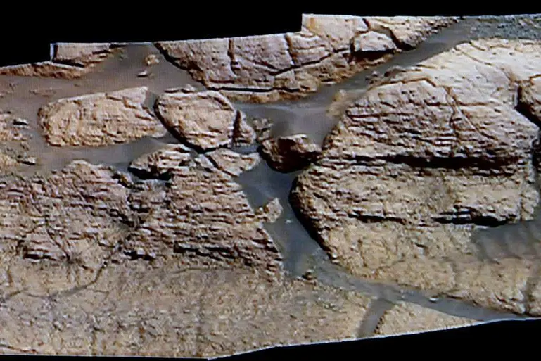
The arm of NASA's Mars Exploration Rover Opportunity is seen extended toward a light-toned rock, "Tisdale 2", during the 2,695th Martian day, or "sol", of the rover's work on Mars, in this picture taken by the rover's front hazard-avoidance camera on August 23, 2011, and released by NASA September 1, 2011. The rock, "Tisdale 2", is about 12 inches (30 cm) tall. The rover used two instruments on the robotic arm, the microscopic imager and the alpha particle X-ray spectrometer, to examine Tisdale 2. In this image, the turret at the end of the arm is positioned so that the microscopic imager is facing the rock. Picture taken August 23. REUTERS/NASA/JPL-Caltech/Handout
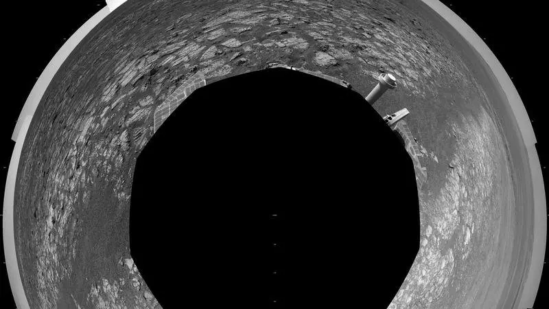
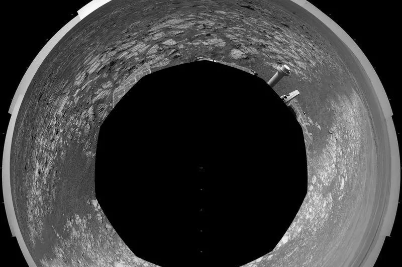
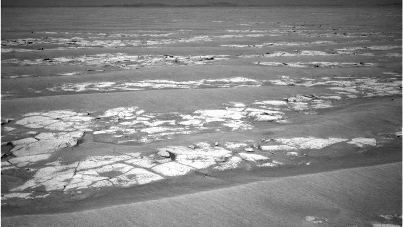
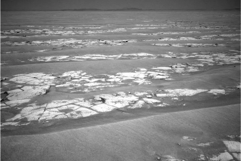
This 360-degree scene assembled from images taken by the navigation camera on NASA's Mars Exploration Rover Opportunity released on September 7, 2012 shows terrain surrounding the position where the rover spent its 3,000th Martian day on July 2, 2012, or sol, working on Mars. The scene is presented as a polar projection in this image, with north at the top. The Sol 3000 site is near the northern tip of the Cape York segment of the western rim of Endeavour Crater. Bright toned material lines the perimeter of Cape York. The component images of this scene were taken during sols 2989 through 2991. Opportunity arrived at this location on Sol 2989 (June 20, 2012) with a drive bringing the mission's total driving distance as of Sol 3000 to 21.432 miles (34,492 meters). It departed with an eastward drive of about 105 feet (32 meters) on Sol 3008 (July 10, 2012). REUTERS/NASA/JPL-Caltech/Handout
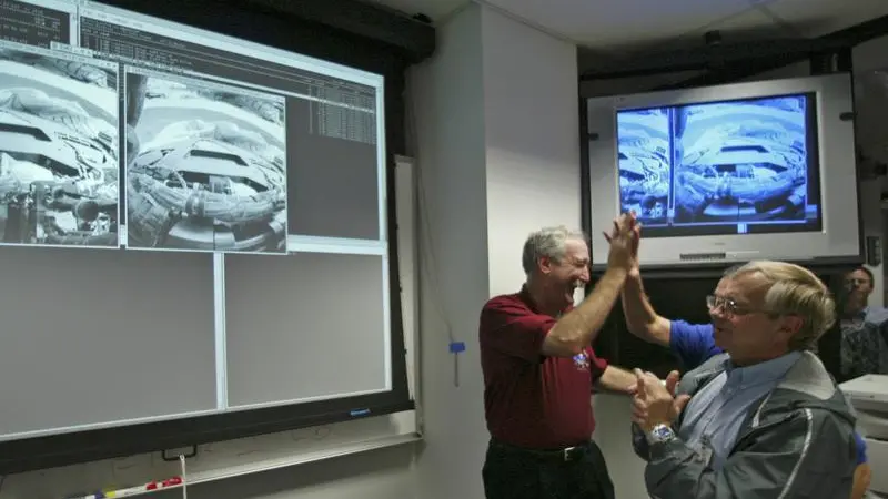
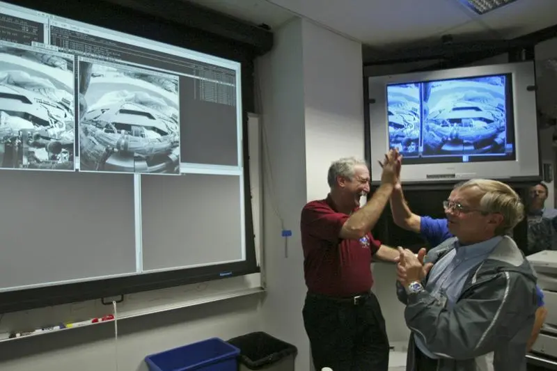
NASA Administrator Sean O'Keefe (L), celebrates with the Director of JPL Dr. Charles Elachi (C) alongside NASA Associate Administrator for Space Sciences Dr. Ed Whiler (R) as they watch as the first images from the Opportunity streamed into the control room of the Jet Propulsion Laboratory in Pasadena, California early January 25, 2004 as the first images from the mars Rover Opportunity filtered in. The Opportunity space craft made a near-perfect landing on the surface of Mars, NASA engineers at the Jet Propulsion Laboratory said on Saturday. At about 9:06 p.m. local time (12:06 a.m. EST/0506 GMT) engineers received a signal that Opportunity had touched down on the Meridiani Planum, a smooth plain near Mars' equator on the other side of the Red Planet from its twin rover, Spirit. Within hours Opportunity was beaming images back to earth. REUTERS/POOL/Damian Dovarganes FG/GM - RP4DRIHVQJAA
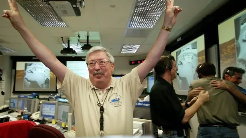

Pete Theisinger, Mars Exploration Rover Project Manager, celebrates the successful egress of the Mars 'Opportunity' rover at NASA's Jet Propulsion Laboratory in Pasadena, California, January 31, 2004.
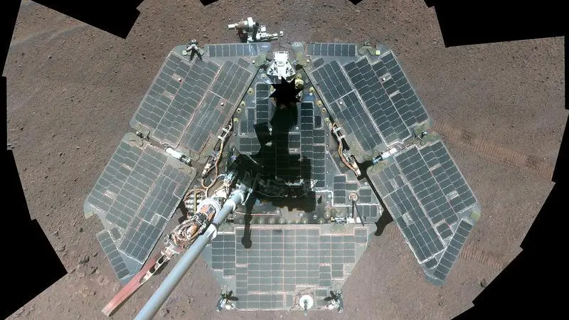
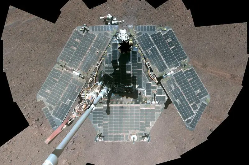
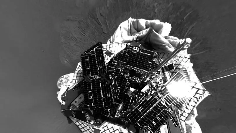
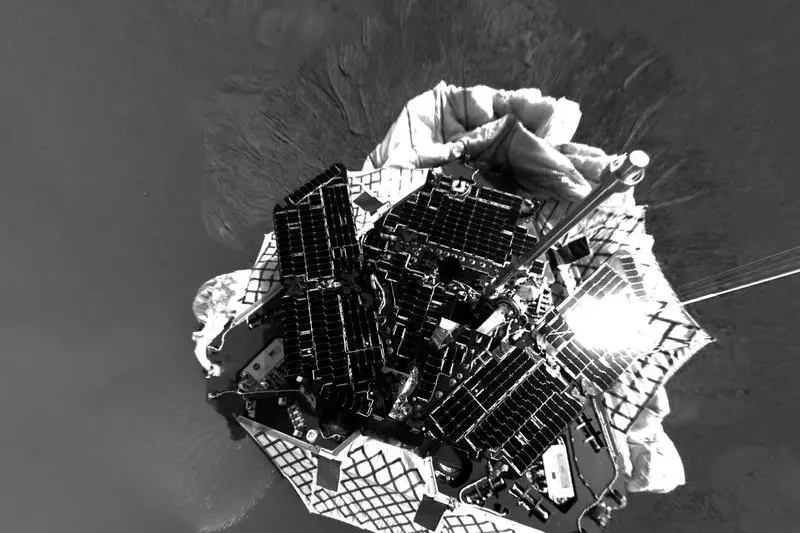
A self-portrait of NASA's Mars Exploration Rover Opportunity, a combination of multiple frames taken by Opportunity's panoramic camera (Pancam) during March 22 through March 24, 2014 on planet Mars is seen in this NASA/JPL-Caltech image released on April 17, 2014.
This view of Mars results from the observation of a target selected autonomously by AEGIS, Autonomous Exploration for Gathering Increased Science (AEGIS) onboard the Opportunity Mars rover, is pictured in this NASA photograph released December 8, 2011. This particular target, a piece of crater ejecta near the Mars Concepcion crater, was detected March 4, 2010, and the image was captured by the Opportunity's Panoramic Camera. AEGIS, novel autonomy software that has been operating on the Mars Exploration Rover Opportunity since December 2009, is NASA's 2011 Software of the Year recipient. REUTERS/NASA/JPL-Caltech/Handout
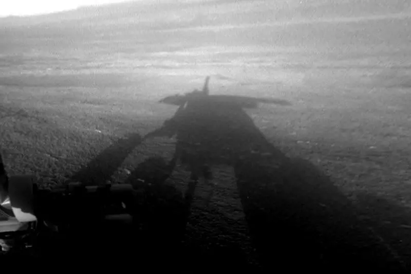
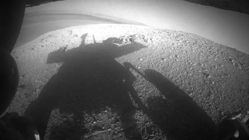
NASA's Mars Exploration Rover Opportunity captured this view of its afternoon shadow stretching into Endeavour Crater on August 23, 2012 and made available on September 7, 2012. The rover was perched on the western rim of the crater, which is 14 miles (22 kilometers) in diameter. Opportunity's front hazard-avoidance camera took this image. The camera has a fisheye lens; the image has been processed to straighten the horizon. REUTERS/NASA/JPL-Caltech/Handout


NASA Mars project members celebrate the successful egress of the Mars 'Opportunity' rover at NASA's Jet Propulsion Laboratory in Pasadena, California, January 31, 2004. Opportunity, NASA's second of two roving Mars probes, rolled 10 feet off its lander onto Mars after having landed in a shallow impact crater at Meridiani Planum late January 24. REUTERS/Lucy Nicholson LN
An image shown by NASA officials March 2, 2004, shows a detail of the planet Mars that they claim shows evidence that parts of the planet were once covered in water, at a NASA press conference in Washington. NASA officials have concluded that the part of Mars that NASA's Opportunity Rover is exploring was soaking wet in the past.

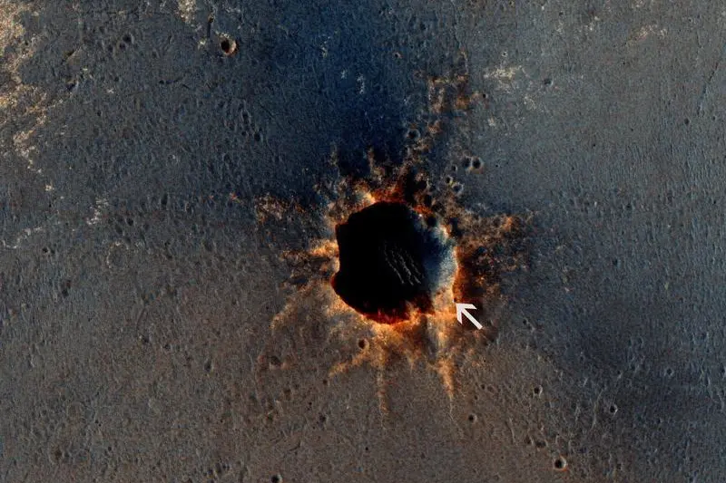
The High Resolution Imaging Science Experiment (HiRISE) camera on NASA's Mars Reconnaissance Orbiter acquired this color image on March 9, 2011, of "Santa Maria" crater, showing NASA's Mars Exploration Rover Opportunity perched on the southeast rim on Mars, in this photograph released by NASA. The rover is the bluish speck at about the four o'clock position on the crater rim (with indicator arrow). North is up. Rover tracks are visible to the west of the crater. REUTERS/NASA/JPL-Caltech/Univ. of Arizona/Handout
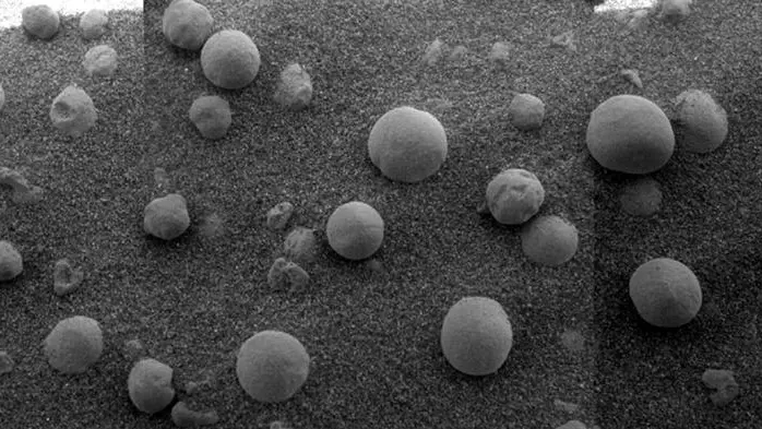
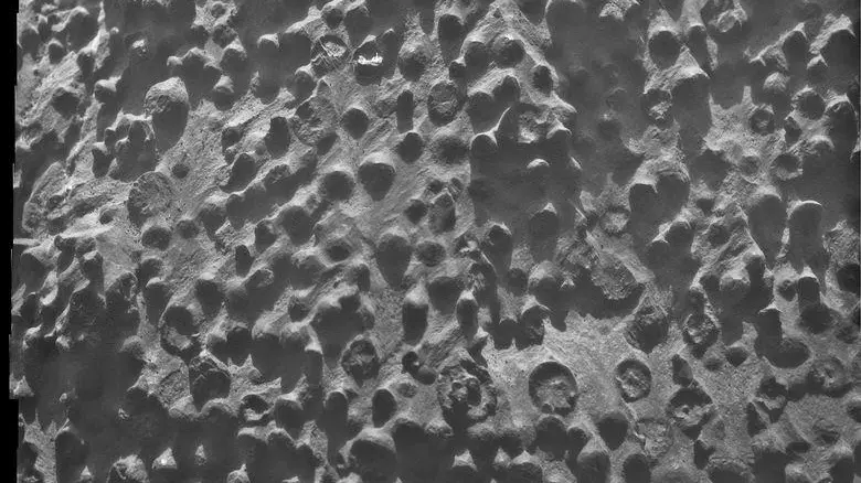
This image released February 12, 2004, from the Opportunity rover shows an extreme close-up of round, blueberry-shaped formations in the Martian soil near a part of the rock outcrop at Meridiani Planum called Stone Mountain. Scientists are studying these curious formations for clues about the soil's formation. (EDITORIAL USE ONLY) REUTERS/HO/NASA/JPL/Cornell JDP
An image shown by NASA officials March 2, 2004, shows a detail of the planet Mars that they claim shows evidence that parts of the planet were once covered in water, at a NASA press conference in Washington. NASA officials have concluded that the part of Mars that NASA's Opportunity Rover is exploring was soaking wet in the past.
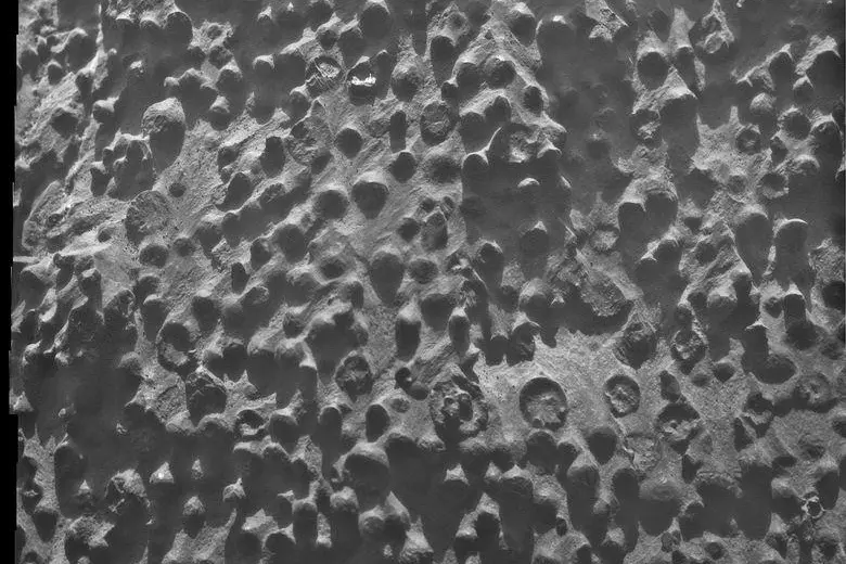
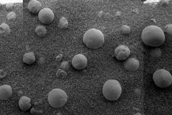
A mosaic combining four images from the Microscopic Imager on NASA's Mars Exploration Rover Opportunity shows small spherical objects filling the field in this handout photo taken September 6, 2012 and released by NASA September 14, 2012. The view covers an area about 2.4 inches (6 centimeters) across, at an outcrop called "Kirkwood" in the Cape York segment of the western rim of Endeavour Crater. The individual spherules are up to about one-eighth inch (3 millimeters) in diameter. REUTERS/NASA/Handout
Tracks left by NASA's Mars Exploration Rover Opportunity as it travels along the rim of Victoria Crater can be seen clearly in this image taken by the High Resolution Imaging Science Experiment (HiRISE) camera on NASA's Mars Reconnaissance Orbiter spacecraft June 26, 2007 and released by NASA June 28, 2007. Opportunity first approached Victoria Crater at an alcove informally named "Duck Bay" (see tracks L). It then drove along the crater's sinuous edge in a clockwise direction before heading back to Duck Bay, where it is expected to enter the crater in early July 2007. Picture taken June 26, 2007. REUTERS/NASA/JPL/University of Arizona/Handout Black and White Only
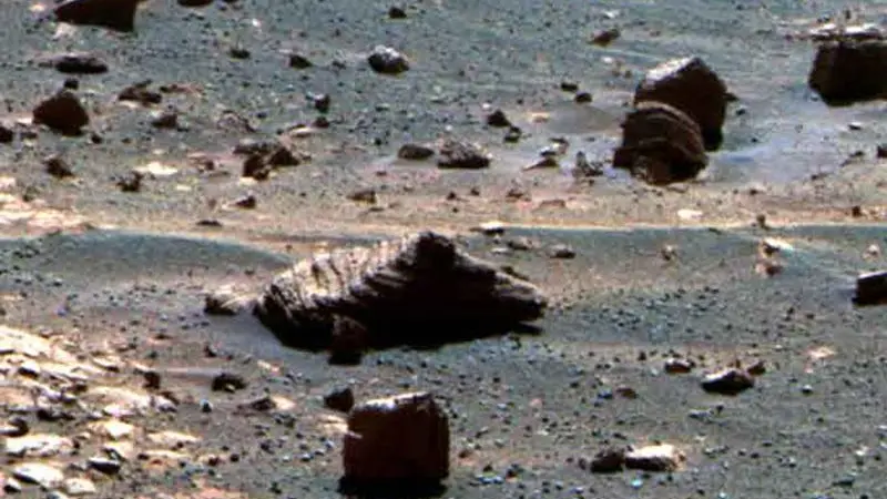
This image released by NASA January 21, 2010, from NASA's Mars Exploration Rover Opportunity shows a rock called "Marquette Island" that was examined from mid-November 2009 until mid-January 2010. Studies of texture and composition suggest that this rock, not much bigger than a basketball, originated deep inside the Martian crust. A crater-digging impact could have excavated the rock and thrown it a long distance, to where Opportunity found it along the rover's long trek across the Meridiani plain toward Endeavour Crater. This true-color view of Marquette Island comes from combining three exposures that Opportunity's panoramic camera took through different filters during the rover's 2,117th Martian day on Mars on January 6, 2010. REUTERS/NASA/JPL-Caltech/Cornell/Handout


Mars Exploration Rover (MER) project manager Pete Theisinger (R) gestures "two for two" as he celebrates the landing of the second rover Opportunity with Jet Propulsion Laboratory Director Charles Elachi (L) and NASA Administrator Sean O'Keefe (2L), 24 January 2004 at the Jet Propulsion Laboratory in Pasadena, California. "Opportunity" joins its sister rover "Spirit" on the surface of Mars. REUTERS/POOL/Damian Davarganes rlb/THI - RP4DRIHVPZAA
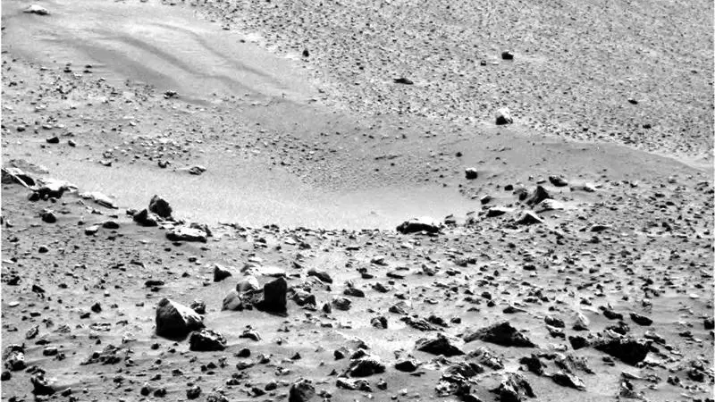
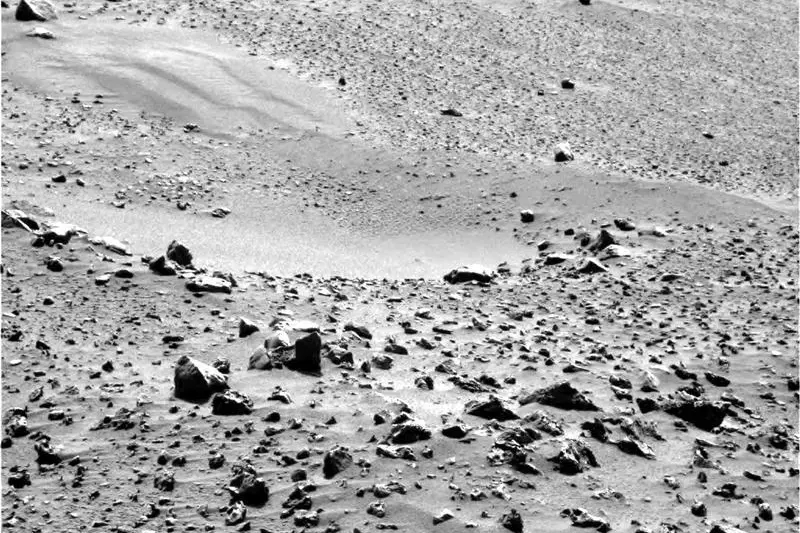
Image from the panoramic camera on the Mars Exploration Rover Opportunity after it touched down at Meridiani Planum, Mars, at approximately 9.05pm PST on January 24. The image was released at the Jet Propulsion Laboratory, Pasadena, California, January 26, 2004. (CREDIT : REUTERS/NASA/JPL)
In this image released by NASA October 28, 2010, NASA's Mars Exploration Rover Opportunity used its navigation camera to record this view at the end of a 111-meter (364-foot) drive on the 2,353rd Martian day, or sol, of the rover's mission on Mars (September 6, 2010). Opportunity began the trip from Victoria to Endeavour crater in September 2008 after two years of exploring in and around Victoria. After the rover science team selected Endeavour as the rover's next long-term destination, observations of Endeavour's rim by NASA's Mars Reconnaissance Orbiter revealed the presence of clay minerals. This finding makes the site an even more compelling science destination. Clay minerals, which form exclusively under wet conditions, have been found extensively on Mars from orbit, but have not been examined on the surface. Opportunity completed its three-month prime mission on Mars in April 2004 and has been operating as an extended mission since then. REUTERS/NASA/JPL-Caltech/Cornell University/Handout
Mars Opportunity rover goes dark
The mission is over for NASA's Opportunity rover, which went silent following a Martian dust storm in June 2018, after 14 years of exploring Mars.