This image from the right Mast Camera (Mastcam) of NASA's Curiosity Mars rover shows rough spherical features on the surface of the planet in an area called 'Yellowknife Bay' in this NASA handout released January 15, 2013. These features are interpreted as concretions, implying they formed in water that percolated through pores in the sediment. Spherical concretions have previously been discovered in other rocks on Mars. REUTERS/NASA/JPL-Caltech/MSSS/Handout
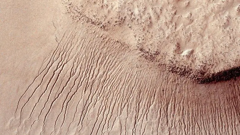
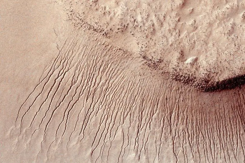
Portions of the Martian surface are pictured, shot by the High Resolution Imaging Science Experiment (HiRISE) camera on NASA's Mars Reconnaissance Orbiter showing many channels from 1 meter to 10 meters wide on a scarp in the Hellas impact basin on Mars. in this photograph taken January 14, 2011 and released by NASA March 9, 2011. REUTERS/NASA/JPL-Caltech/Univ. of Arizona/Handout
This image, cropped from a larger panoramic image mosaic taken by the Mars Exploration Rover Spirit panoramic camera, released by NASA March 18, 2004, shows the rover's destination toward the hills nicknamed the "Columbia Hills." The rover is currently positioned outside the view of this image, on the right. This image was taken on sols 68 and 69 of Spirit's mission (March 12 and 13, 2004) from the location the rover first reached on the western rim of the crater. The image is in approximate true color, based on a scaling of data from the red, green and blue MEDIUM RESOLUTION FROM SOURCE REUTERS/NASA/JPLCornell/USGS EDITORIAL USE ONLY FSP/HB - RTRFJ6D

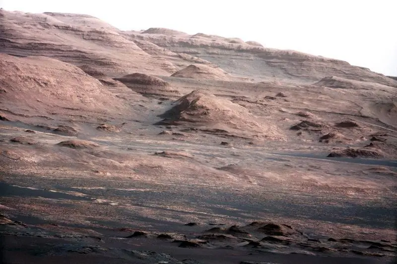
The base of Mars' Mount Sharp - the rover's eventual science destination - is pictured in this August 27, 2012 NASA handout photo taken by the Curiosity rover. The image is a portion of a larger image taken by Curiosity's 100-millimeter Mast Camera on August 23. Scientists enhanced the color to show the Martian scene under the lighting conditions we have on Earth, which helps in analyzing the terrain. REUTERS/NASA/Handout
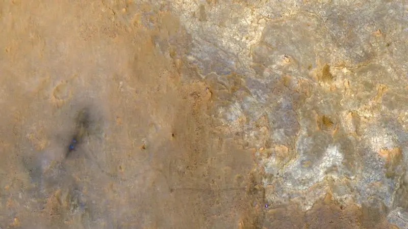
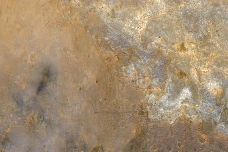
NASA's Mars Science Laboratory rover Curiosity appears as a bluish dot near the lower right corner of this enhanced-color view from the High Resolution Imaging Science Experiment (HiRISE) camera on NASA's Mars Reconnaissance Orbiter taken on June 27, 2013 and released on July 24, 2013. The rover's tracks are visible extending from the landing site, "Bradbury Landing," in the left half of the scene. Two bright, relatively blue spots surrounded by darker patches are where the Mars Science Laboratory spacecraft's landing jets cleared away reddish surface dust at the landing site. REUTERS/NASA/JPL-Caltech/Univ. of Arizona/Handout via Reuters
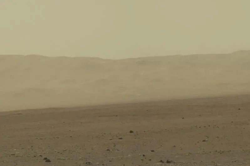
The surface of the planet Mars inside Gale's Crater is shown as NASA's Mars rover Curiosity drives toward a flat rock with pale veins that may hold clues to a wet history on the planet in this NASA handout photo released January 15, 2013. If the rock meets rover engineers' approval when Curiosity rolls up to it in coming days, it will become the first to be drilled for a sample during the Mars Science Laboratory mission. REUTERS/NASA/Handout
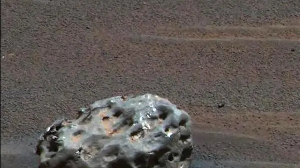
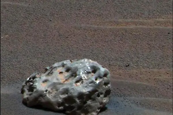
In this image released January 19, 2005, NASA's Mars Exploration Rover "Opportunity": has found an iron meteorite on Mars, the first meteorite of any type ever identified on another planet. The pitted, basketball-size object is mostly made of iron and nickel. This composite combines images taken through the panoramic camera's 600-nanometer (red), 530-nanometer (green), and 480-nanometer (blue) filters REUTERS/NASA/JPL/Cornell/Handout SSM - RTRKZRH
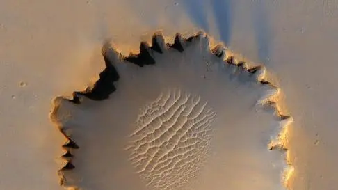
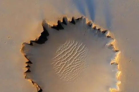
Mars' Victoria Crater at Meridiani Planum is seen in this image taken by NASA's High Resolution Imaging Science Experiment (HiRISE) camera in this picture released October 6, 2006. The crater has been a long-term destination for the Mars Rover mission for the past 21 months, and is now being explored by Mars Rover Opportunity. FOR EDITORIAL USE ONLY REUTERS/NASA/JPL/Caltech/Handout - RTR1I40K
This color image taken August 8, 2012 from NASA's Curiosity rover, and released August 13, shows part of the wall of Gale Crater, the location on Mars where the rover landed on August 5, 2012. This is part of a larger, high-resolution color mosaic made from images obtained by Curiosity's Mast Camera. This image of the crater wall is north of the landing site, or behind the rover. Here, a network of valleys believed to have formed by water erosion enters Gale Crater from the outside. This is the first view scientists have had of a fluvial system - one relating to a river or stream from the surface of Mars. REUTERS/NASA/JPL-Caltech/MSSS/Handout
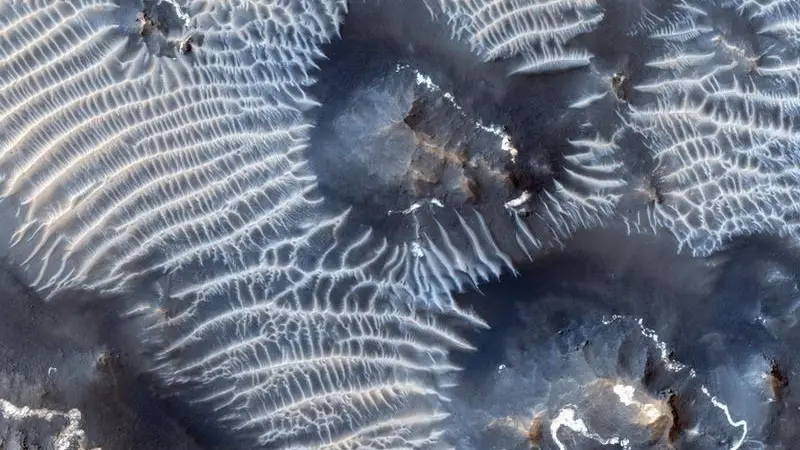
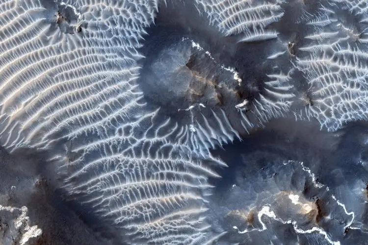
A view of the Noctis Labyrinthus region of Mars, perched high on the Tharsis rise in the upper reaches of the Valles Marineris canyon system is seen in this NASA handout picture acquired on August 31, 2013 by the HiRISE (High Resolution Imaging Science Experiment) instrument aboard NASA's Mars Reconnaissance Orbiter (MRO) and released by NASA on September 24, 2013. Targeting the bright rimmed bedrock knobs, the image also captures the interaction of two distinct types of windblown sediments. Surrounding the bedrock knobs is a network of pale reddish ridges with a complex interlinked morphology. REUTERS/NASA/JPL/University of Arizona/Handout via Reuters
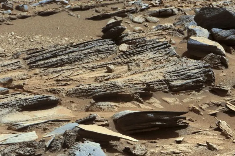
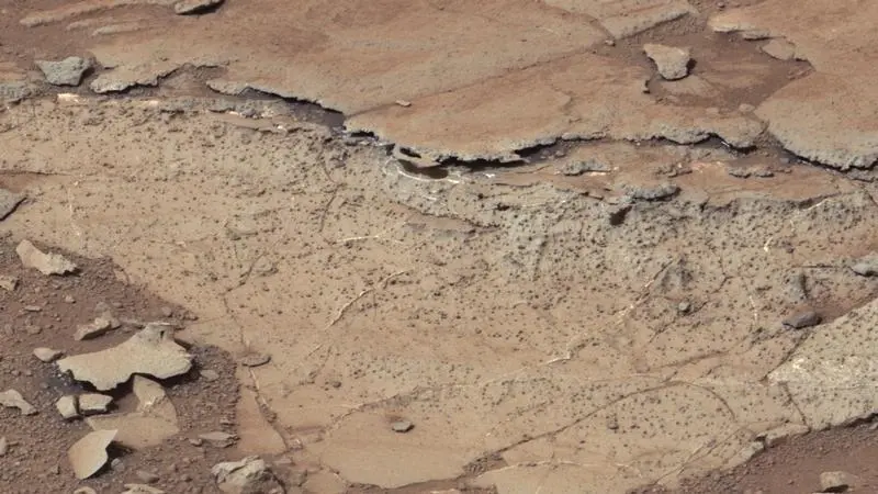
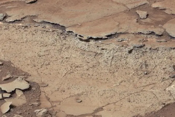
An image from the Mast Camera (Mastcam) on NASA's Mars rover Curiosity shows the surface of the planet with inclined layering known as cross-bedding in an outcrop called "Shaler" on a scale of a few tenths of a meter, or decimeters (1 decimeter is nearly 4 inches) in this NASA handout released January 15, 2013. REUTERS/NASA/JPL-Caltech/MSSS/Handout
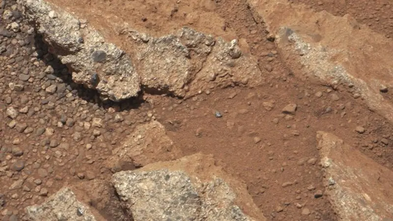
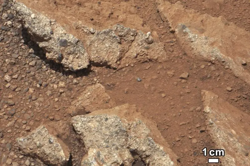
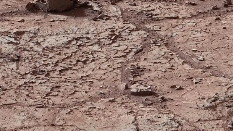
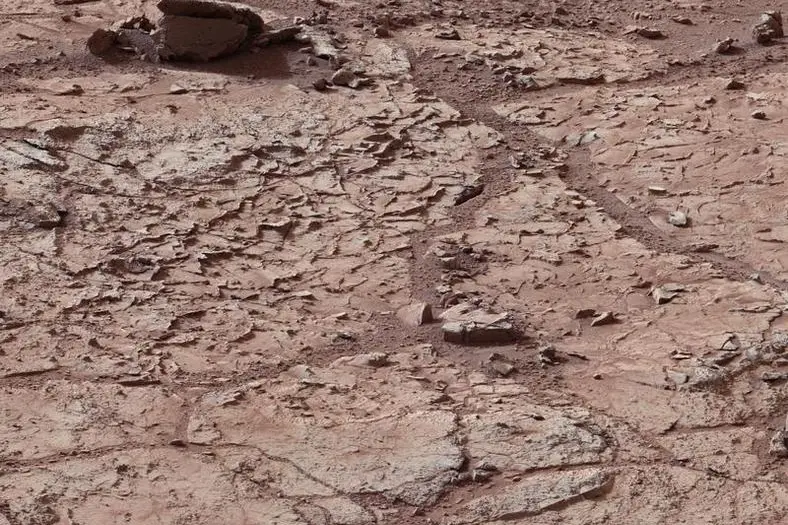
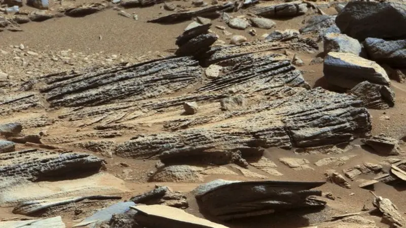
A rock outcrop called Link pops out from a Martian surface in this NASA handout image taken by the 100-millimeter Mast Camera on NASA's Curiosity Mars rover September 2, 2012 and released September 27, 2012. Rounded gravel fragments, or clasts, up to a couple inches (few centimeters) in size are in a matrix of white material. The outcrop characteristics are consistent with a sedimentary conglomerate, or a rock that was formed by the deposition of water and is composed of many smaller rounded rocks cemented together. Scientists enhanced the color in this version to show the Martian scene as it would appear under the lighting conditions we have on Earth, which helps in analyzing the terrain. REUTERS/NASA/JPL-Caltech/MSSS/Handout
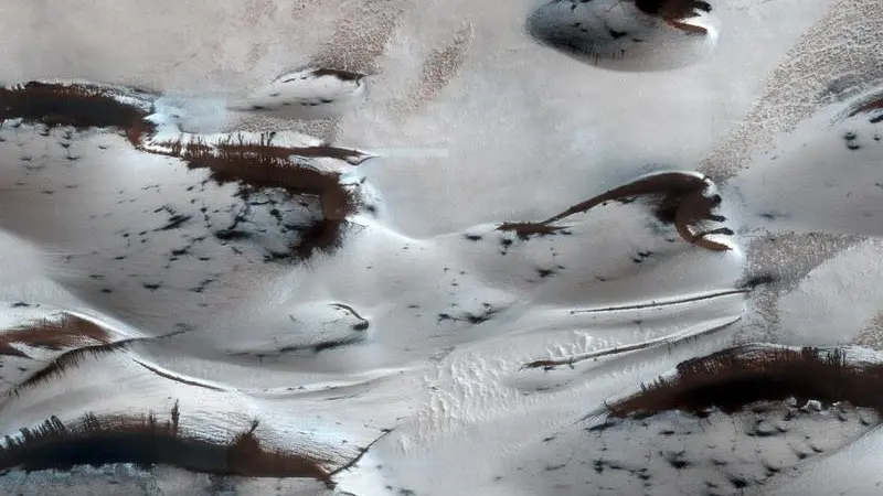
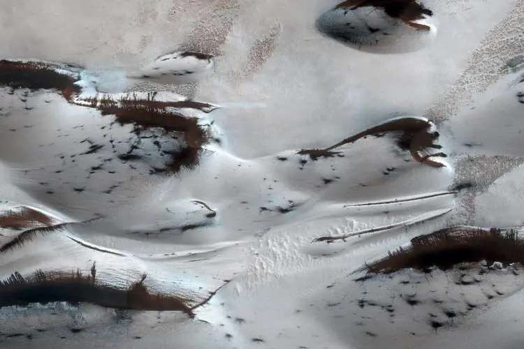
Mars’ northern-most sand dunes are seen as they begin to emerge from their winter cover of seasonal carbon dioxide (dry) ice in this image acquired by the HiRISE camera aboard NASA's Mars Reconnaissance Orbiter January 16, 2014. The steep lee sides of the dunes are also ice-free along the crest, allowing sand to slide down the dune. Dark splotches are places where ice cracked earlier in spring, releasing sand, according to a NASA news release. REUTERS/NASA/JPL-Caltech/Univ. of Arizona/Handout via Reuters
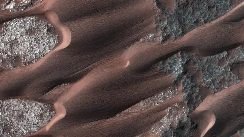
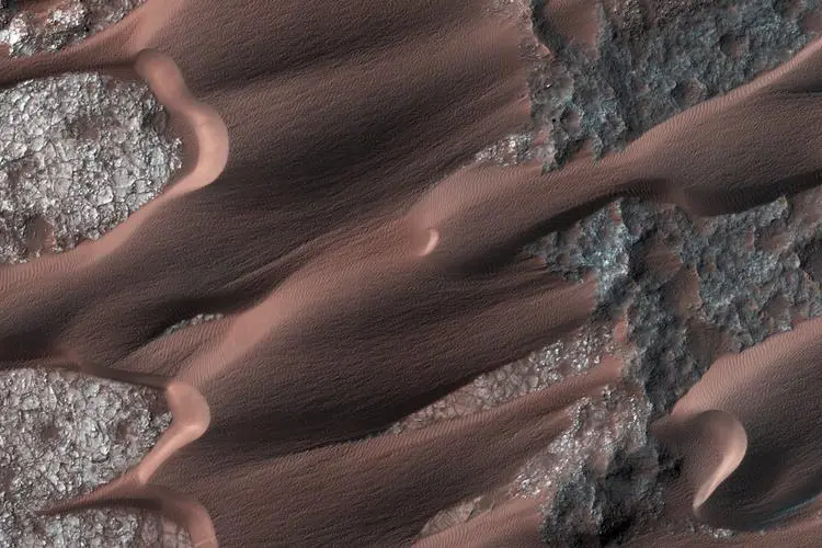
Nili Patera, one of the most active dune fields on the planet Mars is shown in this handout photo taken by NASA's Mars Reconnaissance Orbiter March 1, 2014 and provide by NASA May 2, 2014. By monitoring the sand dune changes, NASA can determine how winds vary seasonally and year-to-year. REUTERS/NASA/JPL-Caltech/Univ. of Arizona/Handout via Reuters
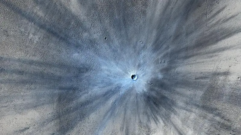
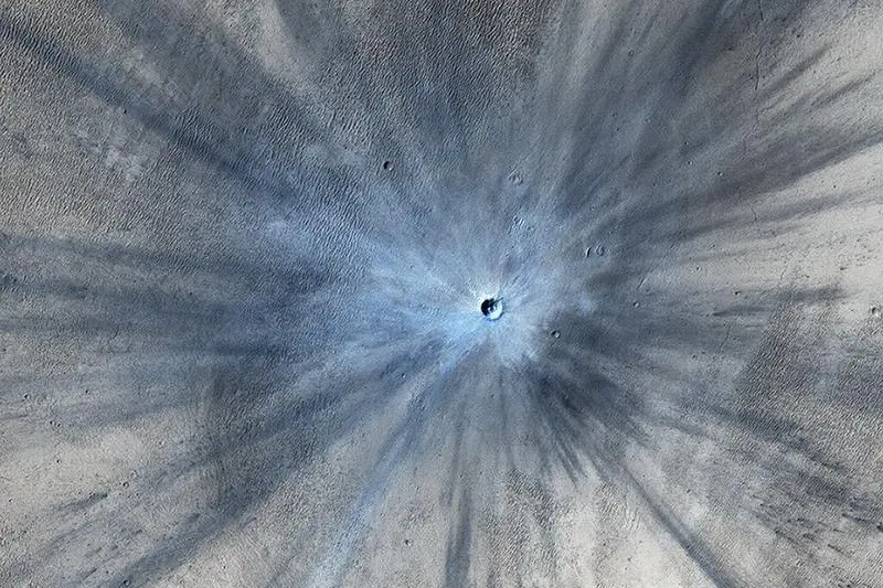
An impact crater on Mars is seen in an image taken by the High Resolution Imaging Science Experiment (HiRISE) camera on NASA's Mars Reconnaissance Orbiter on November 19, 2013 and released February 5, 2014. The crater spans approximately 100 feet (30 meters) in diameter and is surrounded by a large, rayed blast zone. Because the terrain where the crater formed is dusty, the fresh crater appears blue in the enhanced color of the image, due to removal of the reddish dust in that area. REUTERS/NASA/JPL-Caltech/Univ. of Arizona/Handout
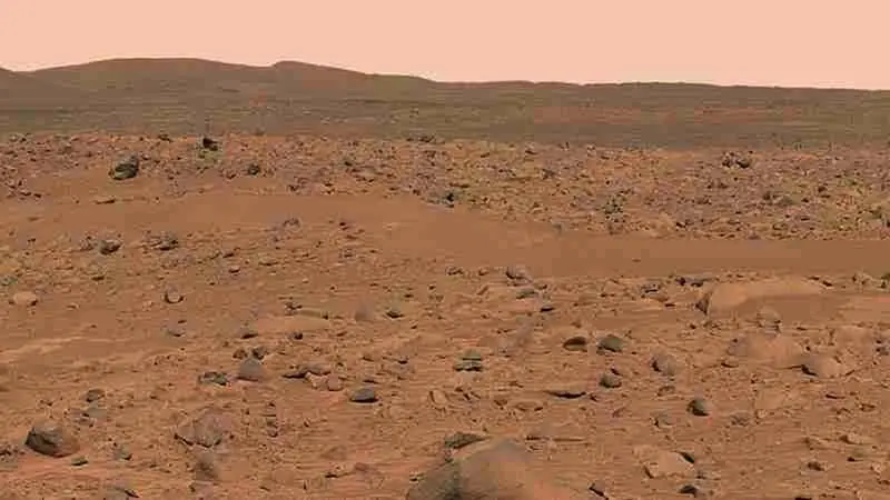
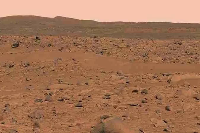
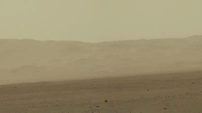
The surface of Mars
What the Red Planet looks like up close.